Nainital
“Nainital, where nature’s beauty meets tranquility, offering an enchanting escape to the soul and a paradise for every traveler.”
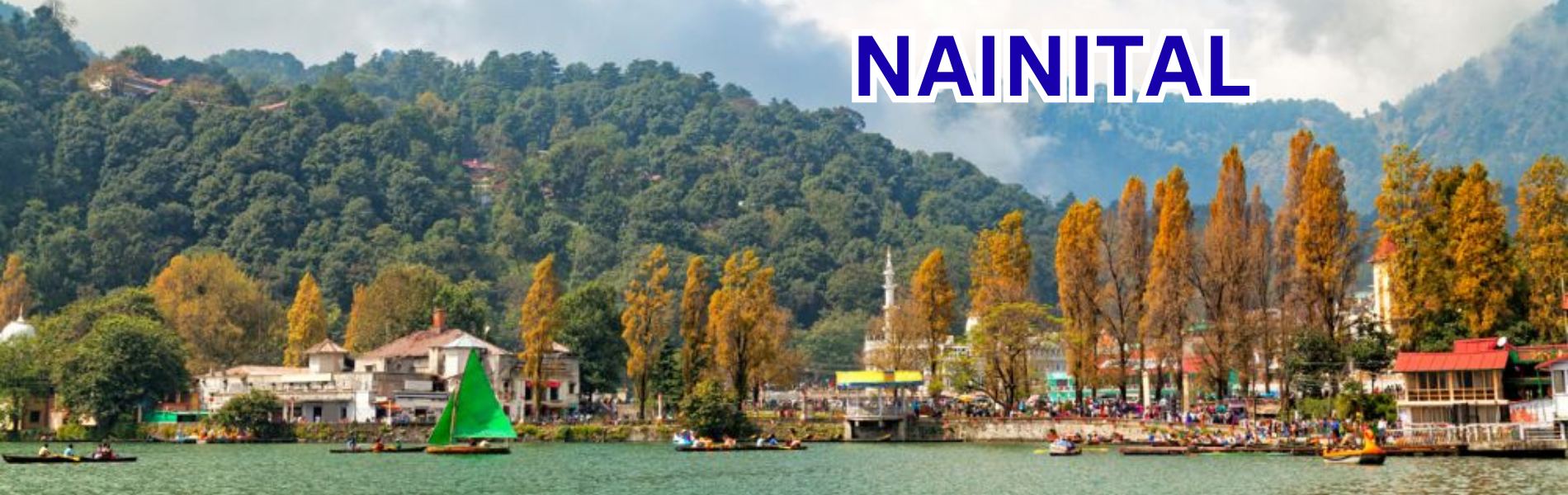
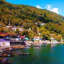
Nainital, located in the Kumaon region of Uttarakhand, India, is the district headquarters of Nainital and also serves as the judicial capital of Uttarakhand, with the state’s High Court situated there. Nestled at an altitude of 1,938 meters (6,358 feet), the town is set in a picturesque valley around the Naini Lake, which is shaped like an eye and surrounded by the Himalayan mountains. The town’s highest peaks include Naina Peak (2,615 m), Deopatha (2,438 m), and Ayarpatha (2,278 m), offering stunning views of the surrounding landscape.
Etymology and Mythology
Nainital derives its name from the Naini Lake, which is believed to be one of the 51 Shakti Peeths associated with the Hindu mythology of Goddess Sati. According to the legend, the right eye of Goddess Sati fell at this spot, which is why it is also known as Nain-tal, or the “lake of the eye.” The Naina Devi Temple, dedicated to Goddess Shakti, is located on the northern shore of the lake.
History
Nainital’s history is rooted in the Kumaon region’s past. After the fall of the Katyuri dynasty in the 10th century, the area was ruled by various local dynasties. It was eventually incorporated into the Chand dynasty, and later, during the reign of Kirat Chand in the 15th century, Nainital came under his control.
In 1841, Nainital was established as a hill station by P. Barron, a sugar trader from Shahjahanpur, marking the beginning of its transformation into a popular tourist destination. It later became the summer capital of the United Provinces under British rule.
The Landslip of 1880
On September 18, 1880, a catastrophic landslide occurred at the north end of Nainital, burying 151 people. The landslide followed heavy rains and a minor earthquake, with the destruction of several buildings, including the Victoria Hotel and the Naina Devi Temple. In response, stormwater drains were constructed and building regulations were strengthened to prevent further disasters.
Geography and Natural Beauty
Nainital covers an area of 11.73 km² and lies at an average elevation of 2,084 meters (6,837 feet). The town is surrounded by several mountains, including Ayarpata, Devpata, and Alma, and is situated around the Naini Lake, which is about 1,433 meters long and 463 meters wide. The lake, formed tectonically, is fed by streams and drains from surrounding mountains, including 26 major drains.
The geological formation of the region is primarily composed of slates, sandstones, and limestones, making it prone to landslides. However, despite these natural challenges, the beauty of the region and its serene landscape continue to attract tourists year-round.
If you’re looking for RTI filing services in Nainital, you can easily access them through our trusted legal partner site, RTIGuru. They provide comprehensive assistance for filing RTI applications, including drafting guidance, tracking, and tutorials to make the process smooth and straightforward.
Here are some frequently asked questions (FAQs) about Nainital:
What is Nainital famous for?
Nainital is famous for its scenic beauty, serene Naini Lake, and as a popular hill station in Uttarakhand. It is known for its pleasant weather, lush greenery, and panoramic views of the surrounding Himalayan peaks. Nainital also holds religious significance due to the Naina Devi Temple, which is one of the 51 Shakti Peeths in India.
How did Nainital get its name?
Nainital gets its name from the Naini Lake, which is believed to be the site where the right eye of Goddess Sati fell, according to Hindu mythology. “Naini” means “eye,” and “Tal” means “lake” in Hindi, together referring to the “lake of the eye.”